A Map Of The Most Photographed Places In The World. Let’s Go To The Least!

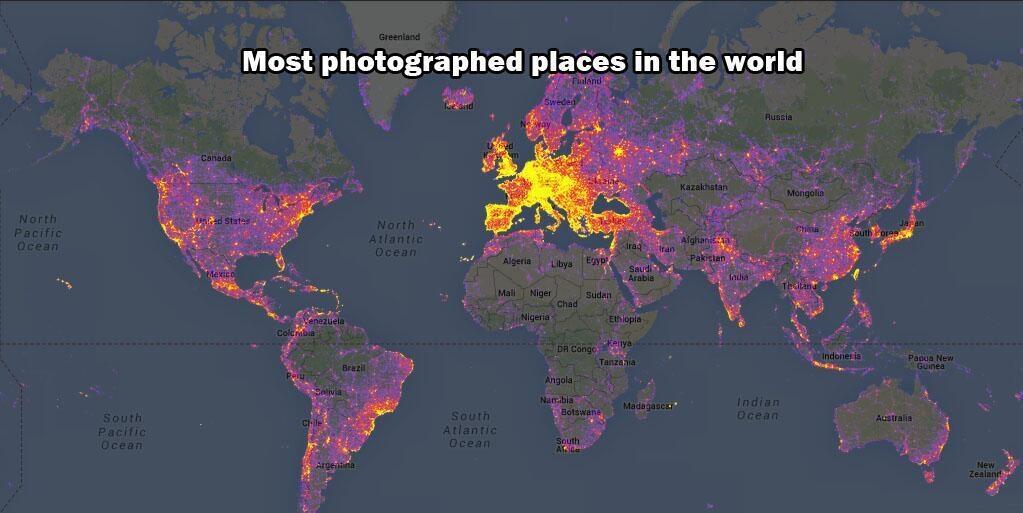
Based on geolocation data from Panorimio, here’s an excellent map of the most photographed places on earth, but together by Bluemoon.ee. While I’m sure a good portion of this map data corrolates with “population density of those who can afford cameras” as Reddit user kingleo1 points out, it’s still an interesting study of where people take pictures.

Now, after looking at this map, my first thought is – I want to go find the least photographed places! Who’s up for a trip to Mongolia?

From Bluemoon.ee: World map color-coded by level of touristiness, based on analysis of photos on Panoramio. Yellow indicates high touristiness, red medium touristiness, and blue low touristiness. Areas having no Panoramio photos at all are grey. The analysis takes into account how many photos and by how many authors there are in a given area.

Most photographed places in the world via @Earth_Pics – Imgur.
And yes, this too.